Something about Adriatic Sea
The Adriatic Sea is a body of water separating the Italian Peninsula from the Balkan peninsula, and the system of the Apennine Mountains from that of the Dinaric Alps and adjacent ranges. The Adriatic Sea is a part of the Mediterranean Sea.
The western coast is Italian, while the eastern coast runs mostly along Croatia, Montenegro, Albania, Slovenia and Bosnia and Herzegovina (26 km). Major rivers joining the Adriatic are the Reno, Po, Adige/Etsch, Brenta, Piave, Soča/Isonzo, Zrmanja, Krka, Cetina, Neretva, Drin (Drini).
Name and etymology
The name has existed since antiquity; in the Latin of the Romans (Ancient Latin) it was Mare Superum; in medieval Latin it was Mare Hadriaticum or Mare Adriaticum. The name, derived from the Etruscan colony of Adria (or Hadria), originally designated only the upper portion of the sea (Herodotus vi. 127, vii. 20, ix. 92; Euripides, Hippolytus, 736), but was gradually extended as the Syracusan colonies gained in importance. The word Adria probably derives from the Illyrian word adur meaning "water" or "sea".
But even then the Adriatic in the narrower sense only extended as far as the Monte Gargano, the outer portion being called the Ionian Sea: the name was sometimes, however, inaccurately used to include the Gulf of Tarentum (the modern-day Gulf of Taranto), the Sea of Sicily, the Gulf of Corinth and even the sea between Crete and Malta (Acts xxvii. 27).
The Adriatic Sea is situated largely between the eastern coast of Italy and Croatia, which are both major tourist attractions. It was used by the ancient Romans to transport goods (including animals and slaves) to Ostia (the Roman port).
Extent and bathymetry
The Adriatic extends northwest from 40° to 45° 45' N., with an extreme length of about 770 km (415 nm, 480 mi). It has a mean breadth of about 160 km (85 nm, 100 mi), although the Strait of Otranto, through which it connects at the south with the Ionian Sea, is only 45-55 nautical miles wide (85-100 km).[3]
Moreover, the chain of islands which fringes the northern part of the eastern shore reduces the extreme breadth of open sea in this part to 145 km (78 nm, 90 mi). Its total surface area is about 60,000 square miles (160,000 km²).
The depths of the Adriatic near its shores share a close relationship to the physiography of the nearby coastlines. Wherever the coasts are high and mountainous, the nearby sea depths are considerable. For instance, in the case of the Istrian and Dalmatian areas of Slovenia and Croatia., the shores are low and sandy, and the nearby sea is shallow, as in the vicinity of Venice or, farther south, near the delta of the Italian Po River. Generally speaking, the waters are shallow all along the Italian coast. The site of maximum depth of the Adriatic Sea is situated south of the central area, and the average depth is 1,457 feet (0.444 km) and maximum depth is 3,300 feet (1.0 km).
Coasts and islands
The west shore is generally low, merging, in the northwest, into the marshes and lagoons on either hand of the protruding delta of the river Po, the sediment of which has pushed forward the coastline for several miles within historic times—Adria is now some distance from the shore.
On islands within one of the lagoons opening from the Gulf of Venice, Venice has its unique situation. Other notable cities on the Italian coast are Trieste, Ravenna, Rimini, Ancona, Pescara, Bari, and Brindisi.
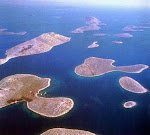
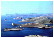
The east coast is generally bold and rocky, with many islands. South of the Istrian Peninsula, which separates the Gulfs of Venice and Trieste from the Bay of Kvarner, the island-fringe of the east coast extends as far south as Dubrovnik. The island of Cres is the largest island in the sea, slightly larger than nearby Krk.
The islands, which are long and narrow (the long axis lying parallel with the coast of the mainland), rise rather abruptly to elevations of a few hundred feet, with the exception of a few larger islands like Brač (Vidova gora, 778 m) or the peninsula Pelješac (St. Ilija, 961 m). There are over a thousand islands in the Adriatic, 66 of which are inhabited.
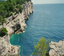
On the mainland, notably in the Gulf of Kotor (Boka Kotorska; named after the town of Kotor), lofty mountains often fall directly to the sea.
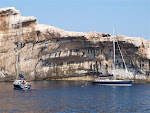
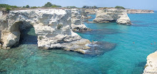
The prevalent colour of the rocks is a light, dead grey, contrasting harshly with the dark vegetation, which on some of the islands is luxuriant. In fact, Montenegro (Black Mountain) was named after the black pines that cover the coast there, and similarly the Greek name for the island of Korčula is Korkyra Melaina meaning "Black Corfu".
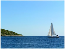
It is interesting to note the vast difference between the Italian and Croatian coasts on the Adriatic. Although only a small distance from each other, the Croatian Coast and beaches are generally many times clearer, cleaner and bluer than Italy's. Croatia is known for its Crystal clear water.
Major cities on the eastern coast include Trieste in Italy; Koper, Izola and Piran in Slovenia; Umag, Poreč, Rovinj, Pula, Opatija, Rijeka, Senj, Zadar, Biograd, Šibenik, Trogir, Split, Makarska, Ploče and Dubrovnik in Croatia; Neum in Bosnia and Herzegovina; Herceg Novi, Kotor, Tivat, Bar, Budva and Ulcinj in Montenegro; Shkodër, Lezhë, Durrës, Fier and Vlorë in Albania.
Weather patterns
The bora (northeast wind), and the prevalence of sudden squalls from this quarter or the southeast, are dangers to navigation in winter. Also notable are sirocco (southern wind) which brings rain in the winter and maestral (western wind) which brings serene weather in the summer. The area is known for occasional waterspouts similar to those found in the Florida Keys.
Tidal movement is slight. The amphidromic point is just off the northwestern shore, near Ancona.
9/09/2007
Subscribe to:
Comments (Atom)
map of adriatic sea

Adriatic sea





.jpg)